
Файл:Karte Ephesos MKL1888.png
Няма версіі з большай раздзяляльнасцю.
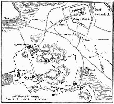
Karte_Ephesos_MKL1888.png (474 × 432 кропак, аб’ём файла: 41 KB, тып MIME: image/png)
Тлумачэнне
| Апісанне | |
| Дата | |
| Крыніца | Encyclopedia: Meyers Konversationslexikon (MKL) |
| Аўтар | MKL cartographers |
Ліцэнзіяванне
| This image comes from the 4th edition of Meyers Konversationslexikon (1885–90). The copyrights have expired and this image is in the public domain. |
|
This work is in the public domain in its country of origin and other countries and areas where the copyright term is the author's life plus 100 years or fewer. This work is in the public domain in the United States because it was published (or registered with the U.S. Copyright Office) before January 1, 1929. | |
| Гэты файл быў ідэнтыфікаваны як вольны ад вядомых абмежаванняў, згодна з законам аб аўтарскім праве, а таксама ад усіх сумежных правоў. | |
Гісторыя файла
Націснуць на даце з часам, каб паказаць файл, якім ён тады быў.
| Дата і час | Драбніца | Памеры | Удзельнік | Тлумачэнне | |
|---|---|---|---|---|---|
| актуальн. | 21:07, 12 снежня 2004 | | 474 × 432 (41 KB) | ¡0-8-15! | {{PD-Meyers}} |
Выкарыстанне файла
Наступныя 2 старонкі выкарыстоўваюць гэты файл:
Глабальнае выкарыстанне файла
Гэты файл выкарыстоўваецца ў наступных вікі:
- Выкарыстанне ў ar.wikipedia.org
- Выкарыстанне ў be-tarask.wikipedia.org
- Выкарыстанне ў bg.wikipedia.org
- Выкарыстанне ў ca.wikipedia.org
- Выкарыстанне ў cs.wikipedia.org
- Выкарыстанне ў da.wikipedia.org
- Выкарыстанне ў de.wikipedia.org
- Выкарыстанне ў en.wikipedia.org
- Выкарыстанне ў es.wikipedia.org
- Выкарыстанне ў fr.wikipedia.org
- Выкарыстанне ў gl.wikipedia.org
- Выкарыстанне ў hi.wikipedia.org
- Выкарыстанне ў hr.wikipedia.org
- Выкарыстанне ў hy.wikipedia.org
- Выкарыстанне ў it.wikipedia.org
- Выкарыстанне ў it.wikivoyage.org
- Выкарыстанне ў jv.wikipedia.org
- Выкарыстанне ў la.wikipedia.org
- Выкарыстанне ў mk.wikipedia.org
- Выкарыстанне ў mr.wikipedia.org
- Выкарыстанне ў mt.wikipedia.org
- Выкарыстанне ў ru.wikipedia.org
- Выкарыстанне ў sl.wikipedia.org
- Выкарыстанне ў stq.wikipedia.org
- Выкарыстанне ў sw.wikipedia.org
- Выкарыстанне ў uk.wikipedia.org
- Выкарыстанне ў vi.wikipedia.org