Арыгінальны файл (3 518 × 1 832 кропак, аб’ём файла: 3,64 MB, тып MIME: image/jpeg)
Гэты файл з на Вікісховішчы і можа выкарыстоўвацца іншымі праектамі. Апісанне на яго старонцы ў Wikimedia Commons прыведзена ніжэй.
Тлумачэнне
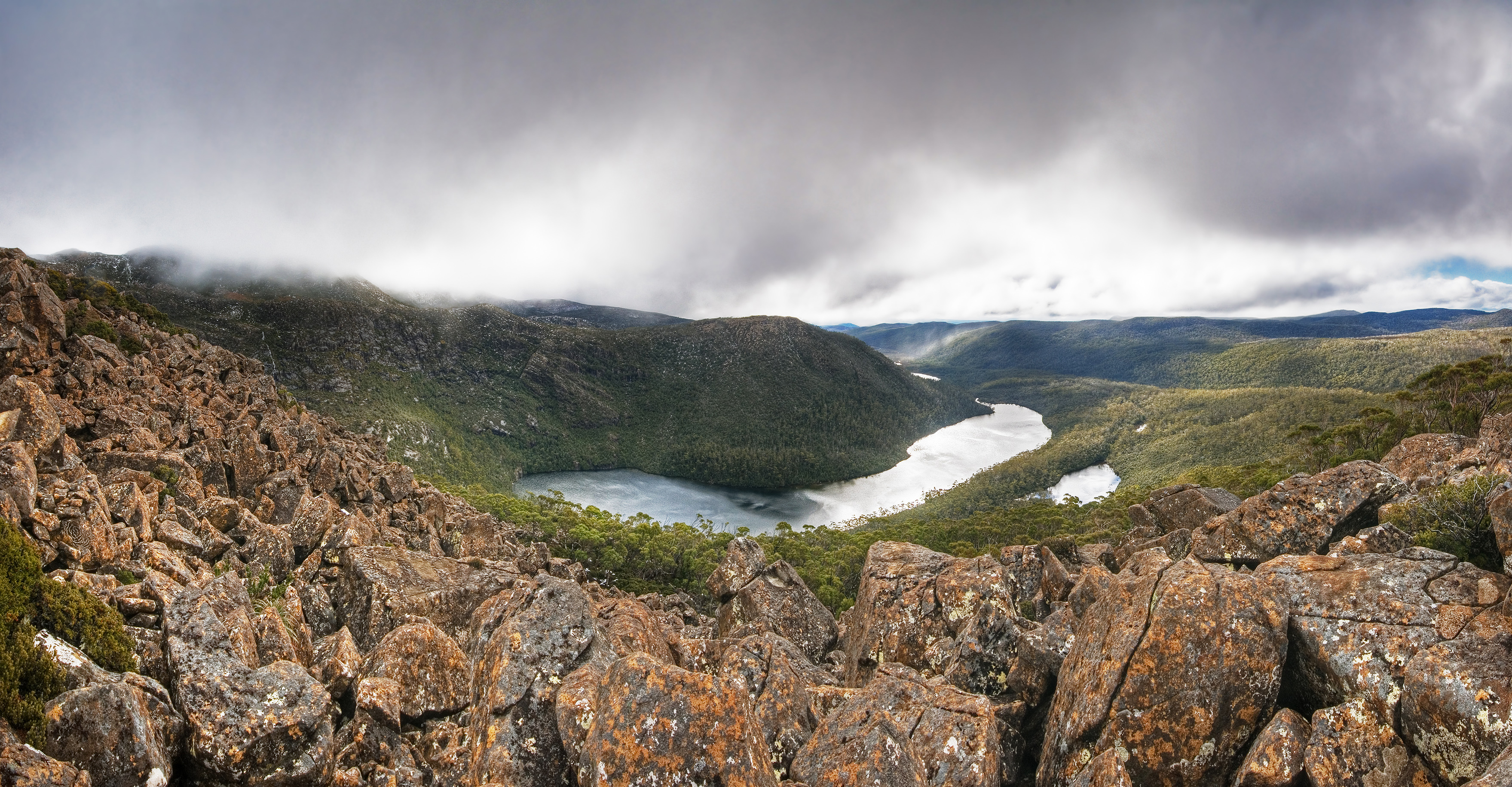
АпісаннеLake Seal Mt Field NP edit.jpg
Lake Seal in Mt Field National Park, Tasmania, Australia. Mt. Bridges centre, Platypus Tarn in the foreground. Lake Webster in the background. The Rodway Range and the Tarn Shelf are partially visible on the left. The rock in the foreground is Dolerite.
Camera data
This is a featured picture on the English language Wikipedia (Featured pictures) and is considered one of the finest images. See its nomination here.
If you think this file should be featured on Wikimedia Commons as well, feel free to nominate it.
If you have an image of similar quality that can be published under a suitable copyright license, be sure to upload it, tag it, and nominate it.
==Summary== {{Information |Description=Lake Seal in Mt Field National Park, Tasmania, Australia. Mt. Bridges centre, Platypus Tarn in the foreground. Lake Webster in the background. The Rodway Range and the Tarn Shelf are partially visible on the left. Th
У файле ёсць дадатковыя звесткі, магчыма, дададзеныя лічбавай фотакамерай ці сканерам, з якіх гэты файл паходзіць. Калі арыгінальны файл быў зменены, то частка гэтых звестак магла страціць актуальнасць у дачыненні да змененага файла.


