
Файл:Livland 15jh.png
Памер папярэдняга прагляду: 666 × 599 пікселяў. Іншыя разрозненні: 267 × 240 пікселяў | 533 × 480 пікселяў | 1 000 × 900 пікселяў.
Арыгінальны файл (1 000 × 900 кропак, аб’ём файла: 2,23 MB, тып MIME: image/png)
Тлумачэнне
| Апісанне |
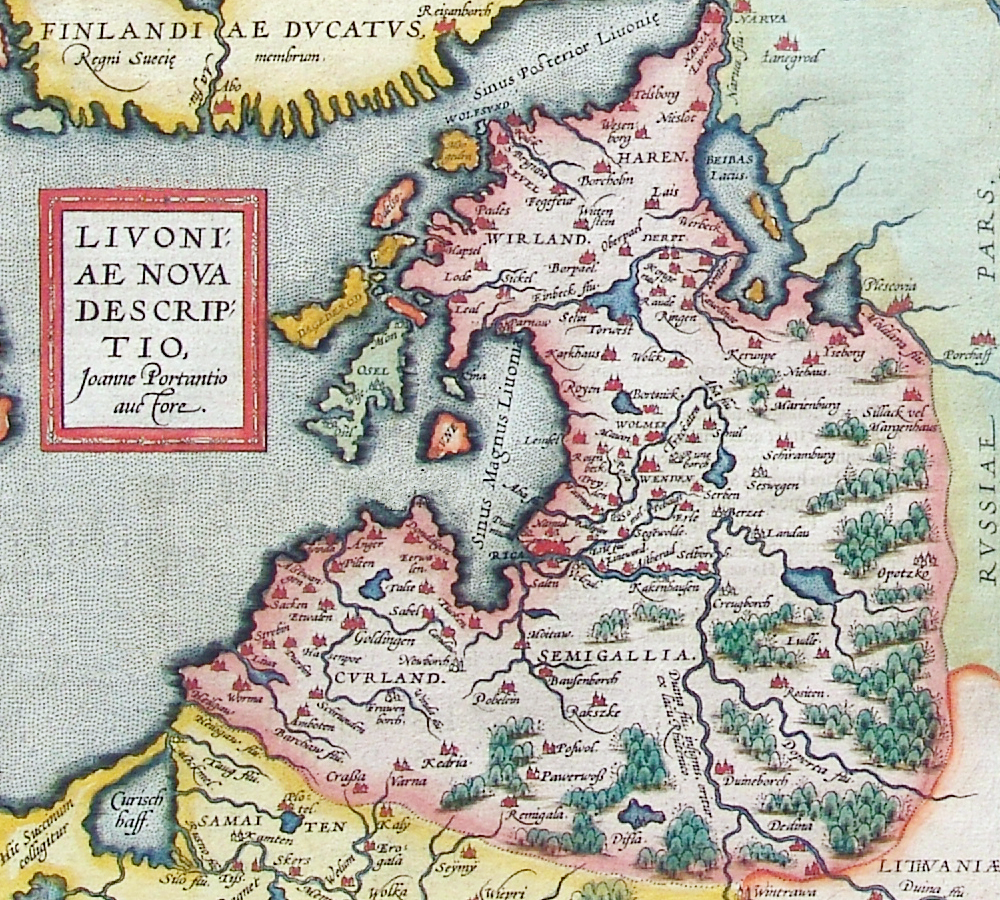
лацінская:
Livoniae nova descriptio, Joanne Portantio auctore. Deutsch: Historische Karte von Livland, vermutlich im 15. Jahrhundert.
English: Historical map of Livonian Confederation, Antwerpen, 1573–1598. First published in Theatrum Orbis Terrarum (1570–1612) by Abraham Ortelius.
22 × 24 см |
| Дата | 1573 - 1598 |
| Крыніца |
Deutsch: Erbstück
Scan by Exxu |
| Аўтар | Joannes Portantius |
| Іншыя версіі |
 |
Ліцэнзіяванне
|
This work is in the public domain in its country of origin and other countries and areas where the copyright term is the author's life plus 100 years or fewer. | |
| Гэты файл быў ідэнтыфікаваны як вольны ад вядомых абмежаванняў, згодна з законам аб аўтарскім праве, а таксама ад усіх сумежных правоў. | |
Гісторыя файла
Націснуць на даце з часам, каб паказаць файл, якім ён тады быў.
| Дата і час | Драбніца | Памеры | Удзельнік | Тлумачэнне | |
|---|---|---|---|---|---|
| актуальн. | 03:01, 12 лістапада 2006 | | 1 000 × 900 (2,23 MB) | MapMaster | Beschreibung: Historische Karte von Livland, vermutlich 15. Jahrhundert Description: Historical map of Livonia, likely 15th century Quelle: Erbstück Urheber: unbekannt Datum vermutlich: 15. Jahrhundert Scan by Benutzer:Exxu This is a copy of [[w:de::Bil |
Выкарыстанне файла
Наступная 1 старонка выкарыстоўвае гэты файл:
Глабальнае выкарыстанне файла
Гэты файл выкарыстоўваецца ў наступных вікі:
- Выкарыстанне ў ar.wikipedia.org
- Выкарыстанне ў be-tarask.wikipedia.org
- Выкарыстанне ў ca.wikipedia.org
- Выкарыстанне ў da.wikipedia.org
- Выкарыстанне ў de.wikipedia.org
- Выкарыстанне ў en.wikipedia.org
- Выкарыстанне ў eo.wikipedia.org
- Выкарыстанне ў et.wikipedia.org
- Выкарыстанне ў eu.wikipedia.org
- Выкарыстанне ў fr.wikipedia.org
- Выкарыстанне ў hu.wikipedia.org
- Выкарыстанне ў it.wikipedia.org
- Выкарыстанне ў ka.wikipedia.org
- Выкарыстанне ў la.wikipedia.org
- Выкарыстанне ў lv.wikipedia.org
- Выкарыстанне ў nl.wikipedia.org
- Выкарыстанне ў pt.wikipedia.org
- Выкарыстанне ў ru.wikipedia.org
- Выкарыстанне ў sh.wikipedia.org
- Выкарыстанне ў sk.wikipedia.org
- Выкарыстанне ў tr.wikipedia.org
- Выкарыстанне ў tt.wikipedia.org
- Выкарыстанне ў uk.wikipedia.org
- Выкарыстанне ў www.wikidata.org