
Файл:Persia 1814.jpg
Памер папярэдняга прагляду: 718 × 600 пікселяў. Іншыя разрозненні: 287 × 240 пікселяў | 575 × 480 пікселяў | 920 × 768 пікселяў | 1 226 × 1 024 пікселяў | 2 452 × 2 048 пікселяў | 2 931 × 2 448 пікселяў.
Арыгінальны файл (2 931 × 2 448 кропак, аб’ём файла: 1,6 MB, тып MIME: image/jpeg)
Тлумачэнне
| Апісанне |
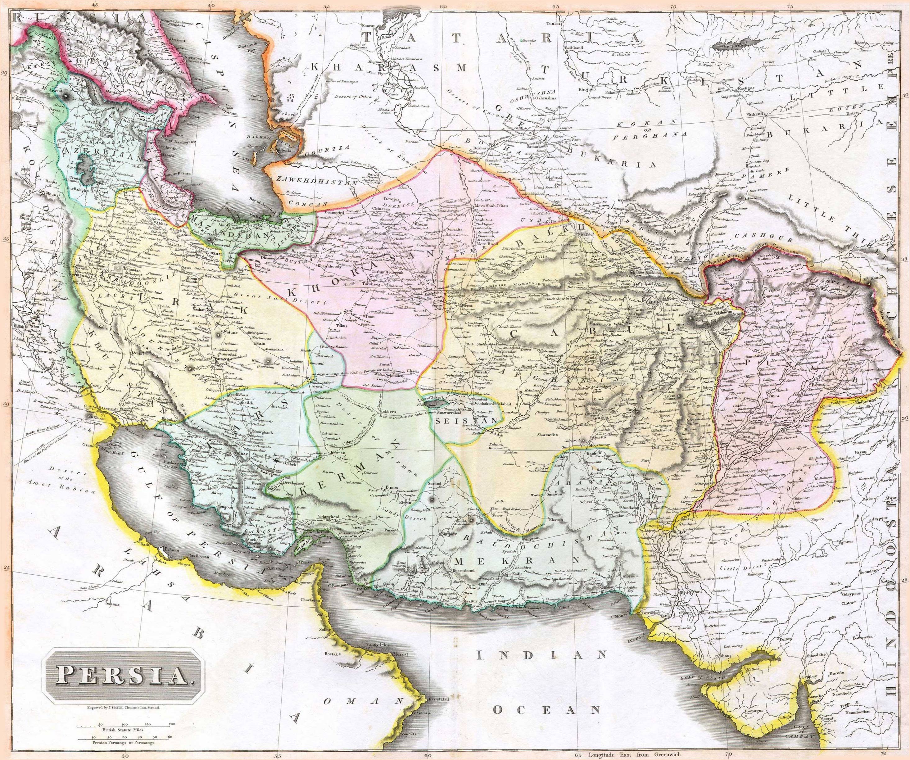
English: 1814 Thomson Map of Persia (Iran), engraved by J. Smith, Clement's Inn, Strand. |
| Дата | |
| Стваральнік твора |
J. Smith, Clement's Inn, Strand. |
| Geotemporal data | |
| Map location | Iran |
| Georeferencing | If inappropriate please set warp_status = skip to hide. |
| Bibliographic data | |
| Публікацыя |
New General Atlas (1821) |
| Аўтар |
John Thomson |
| Іншыя версіі | |

Ліцэнзіяванне
The copyright situation of this work is theoretically uncertain, because in the country of origin copyright lasts 70 years after the death of the author, and the date of the author's death is unknown. However, the date of creation of the work was over 120 years ago, and it is thus a reasonable assumption that the copyright has expired (see here for the community discussion). Do not use this template if the date of death of the author is known.
This work is in the public domain in the United States because it was published (or registered with the U.S. Copyright Office) before January 1, 1929. | |
| Гэты файл быў ідэнтыфікаваны як вольны ад вядомых абмежаванняў, згодна з законам аб аўтарскім праве, а таксама ад усіх сумежных правоў. | |
Гісторыя файла
Націснуць на даце з часам, каб паказаць файл, якім ён тады быў.
| Дата і час | Драбніца | Памеры | Удзельнік | Тлумачэнне | |
|---|---|---|---|---|---|
| актуальн. | 10:27, 18 жніўня 2010 | | 2 931 × 2 448 (1,6 MB) | Begoon | edge perspective and crop |
| 05:35, 19 лістапада 2006 |  | 2 979 × 2 520 (1,45 MB) | Kaveh | == Summary == 1814 Thomson Map of Persia (Iran) Category:Maps of Iran == Licensing == {{PD-old}} |
Выкарыстанне файла
Наступная 1 старонка выкарыстоўвае гэты файл:
Глабальнае выкарыстанне файла
Гэты файл выкарыстоўваецца ў наступных вікі:
- Выкарыстанне ў ar.wikipedia.org
- Выкарыстанне ў az.wikipedia.org
- Выкарыстанне ў bn.wikipedia.org
- Выкарыстанне ў bs.wikipedia.org
- Выкарыстанне ў ca.wikipedia.org
- Выкарыстанне ў da.wikipedia.org
- Выкарыстанне ў de.wikipedia.org
- Выкарыстанне ў en.wikipedia.org
- Выкарыстанне ў es.wikipedia.org
- Выкарыстанне ў eu.wikipedia.org
- Выкарыстанне ў fa.wikipedia.org
- Выкарыстанне ў fr.wikipedia.org
- Выкарыстанне ў hi.wikipedia.org
- Выкарыстанне ў hr.wikipedia.org
Паказаць глабальнае выкарыстанне гэтага файла.