
Файл:City of London skyline from London City Hall - Oct 2008.jpg

Памер папярэдняга прагляду: 800 × 420 пікселяў. Іншыя разрозненні: 320 × 168 пікселяў | 640 × 336 пікселяў | 1 024 × 537 пікселяў | 1 280 × 671 пікселяў | 2 560 × 1 343 пікселяў | 8 441 × 4 427 пікселяў.
Арыгінальны файл (8 441 × 4 427 кропак, аб’ём файла: 10,81 MB, тып MIME: image/jpeg)
Тлумачэнне
| Апісанне |
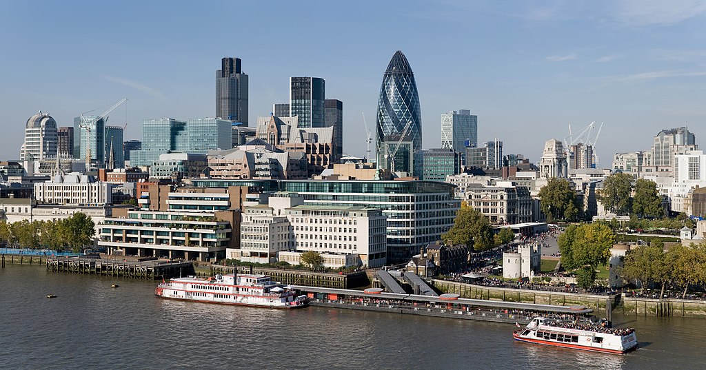
English: The City of London skyline as viewed toward the north-west from the top floor viewing platform of London City Hall on the southern side of the Thames. In the foreground: Dixie Queen and Millennium Time at Tower Millennium Pier. This is a 5 segment panoramic image taken by myself with a Canon 5D and 24-105mm f/4L IS lens. |
| Дата | |
| Крыніца | Уласная праца |
| Аўтар | Diliff |
| Дазвол (Паўторнае выкарыстанне гэтага файла) |
Summary:In using this image or any subsequent derivatives of it, you are required to release the image under the same license. As such, any reproduction of this image, in any medium, must appear with a copy of, or full URL of the license.Attribution of this image to the author (DAVID ILIFF) is also required, preferably in a prominent location near the image.No other conditions may be added to, or removed from this license without the permission of the author and copyright holder.Suggested attribution: "Photo by DAVID ILIFF. License: CC BY-SA 3.0"Please review the full license requirements carefully before using this image. If you would like to clarify the terms of the license or negotiate less restrictive commercial licensing outside of the bounds of GFDL/CC-BY-SA, please contact me by email, or if you don't have a Wikipedia account you can either leave a message on my talk page with your contact details and your request, or you can contact me on Facebook. Please also send a 'friend request' to ensure that I am aware of your message. |
| Іншыя версіі |
  |
| Camera location | | View this and other nearby images on: OpenStreetMap |
|---|
Ліцэнзіяванне
Я, уладальнік аўтарскіх правоў на гэты твор, добраахвотна публікую яго на ўмовах наступных ліцэнзій:
Гэты файл даступны па ліцэнзіі Creative Commons Пазначэнне аўтарства - На тых самых умовах 3.0 Непартаваная
- Вы можаце свабодна:
- дзяліцца творам – капіраваць, распаўсюджваць і перадаваць гэты твор.
- ствараць вытворныя творы – адаптаваць гэты твор
- Пры выкананні наступных умоў:
- атрыбуцыя – вы павінны пазначыць аўтарства гэтага твора, даць спасылку на ліцэнзію і пазначыць ці рабіў аўтар якія-небудзь змены. Гэта можна рабіць кожным зразумелым чынам, але не так, каб наводзіць па думку, што ліцэнзіят падтрымлівае вас або выкарыстанне вамі гэтага твора.
- распаўсюджванне на тых жа ўмовах – Калі вы змяняеце, адаптуеце ці ствараеце вытворны твор на аснове гэтага, то павінны распаўсюджваць атрыманы ў выніку твор на ўмовах такой самай ці сумяшчальнай ліцэнзіі, што і арыгінал.

|
Дазваляецца капіяваць, распаўсюджваць і(або) мадыфікаваць гэты дакумент на ўмовах ліцэнзіі GNU FDL версіі 1.2 або навейшай, выдадзенай Фондам свабоднага праграмнага забеспячэння; без Нязменных раздзелаў, без тэкстаў Вокладак. Копія ліцэнзіі ёсць у раздзеле GNU Free Documentation License. |
Вы можаце выбраць любую з гэтых ліцэнзій.
Адзнакі
|
|
|
| Annotations | This image is annotated: View the annotations at Commons |
Гісторыя файла
Націснуць на даце з часам, каб паказаць файл, якім ён тады быў.
| Дата і час | Драбніца | Памеры | Удзельнік | Тлумачэнне | |
|---|---|---|---|---|---|
| актуальн. | 10:41, 24 чэрвеня 2012 | | 8 441 × 4 427 (10,81 MB) | Tim! | Reverted to version as of 12:54, 12 October 2008 |
| 15:54, 12 кастрычніка 2008 |  | 8 441 × 4 427 (10,81 MB) | Diliff | {{Information |Description={{en|1=The City of London skyline as viewed toward the north-west from the top floor viewing platform of London City Hall on the southern side of the Thames. This is a 5 segment panoramic image taken by myself with a Canon 5D an |
Выкарыстанне файла
Наступная 1 старонка выкарыстоўвае гэты файл:
Глабальнае выкарыстанне файла
Гэты файл выкарыстоўваецца ў наступных вікі:
- Выкарыстанне ў af.wikipedia.org
- Выкарыстанне ў ar.wikipedia.org
- Выкарыстанне ў az.wikipedia.org
- Выкарыстанне ў az.wiktionary.org
- Выкарыстанне ў be-tarask.wikipedia.org
- Выкарыстанне ў bg.wikipedia.org
- Выкарыстанне ў bs.wikipedia.org
- Выкарыстанне ў ca.wikipedia.org
- Выкарыстанне ў cy.wikipedia.org
- Выкарыстанне ў de.wikipedia.org
- Выкарыстанне ў en.wikipedia.org
- Tower Millennium Pier
- Wikipedia:WikiProject UK geography
- Wikipedia talk:WikiProject UK geography
- User:Diliff
- Portal:London/Pictures/Wikipedia featured pictures
- Wikipedia:Featured pictures/Places/Panorama
- Portal:United Kingdom/Featured picture
- Wikipedia:WikiProject UK geography/Announcements
- Wikipedia:Featured pictures thumbs/13
- Metropolis
- Wikipedia:Featured picture candidates/October-2008
- Wikipedia:Featured picture candidates/City of London skyline
- Wikipedia:Wikipedia Signpost/2008-11-08/Features and admins
- Wikipedia:Wikipedia Signpost/2008-11-08/SPV
- Wikipedia:Picture of the day/June 2009
- Template:POTD/2009-06-08
- User talk:Diliff/Archive6
- List of central business districts
- Wake Up to Money
- User:Quibik/Montage
- Portal:London/Featured picture
- Portal:London/Featured picture/12
- User talk:Sabrebd/Autoarchive 4
- Talk:United Kingdom/Archive 27
- User talk:Ottoniel B
- Portal:United Kingdom/Featured picture/47
- Talk:London/Archive 11
- Template:User Part Time Resident-London
Паказаць глабальнае выкарыстанне гэтага файла.