
Файл:Khanate of Karabakh in 1809-1817.JPG

Арыгінальны файл (662 × 616 кропак, аб’ём файла: 80 KB, тып MIME: image/jpeg)
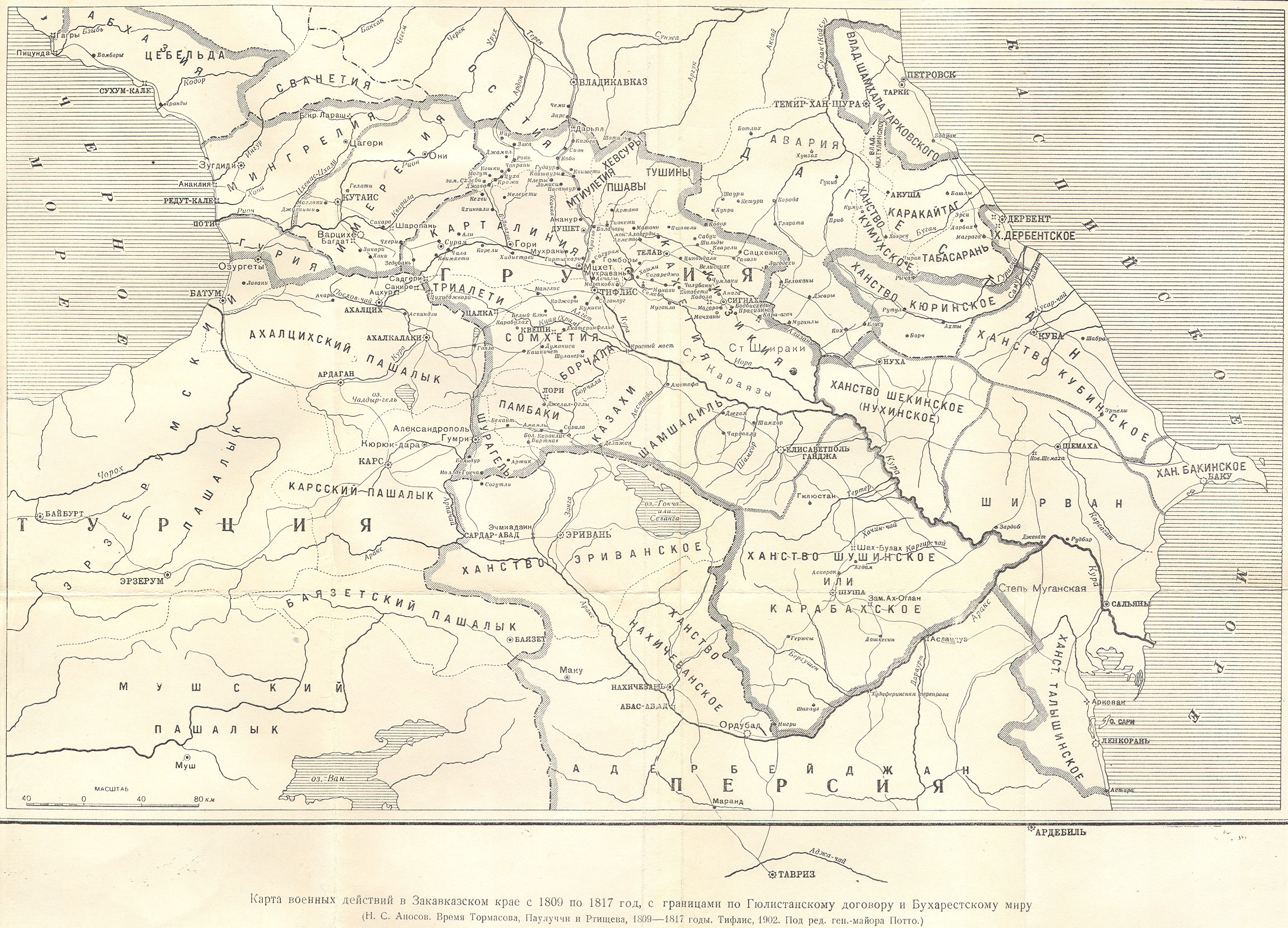
| Апісанне | Azerbaijani khanate of Karabakh in the map of Caucasus in 1809-1817 years (Карта военных действий в Закавказском крае с 1809 по 1817 год) | ||||
| Дата | 1902, Тифлис | ||||
| Крыніца |
|
||||
| Аўтар | под редакцией ген.-майора Потто. Postwork by Interfase | ||||
| Дазвол (Паўторнае выкарыстанне гэтага файла) |
|
||||
Гісторыя файла
Націснуць на даце з часам, каб паказаць файл, якім ён тады быў.
| Дата і час | Драбніца | Памеры | Удзельнік | Тлумачэнне | |
|---|---|---|---|---|---|
| актуальн. | 10:30, 24 чэрвеня 2010 | | 662 × 616 (80 KB) | Interfase | {{Information |Description=Azerbaijani khanate of Karabakh in the map of Caucasus in 1809-1817 years (Карта военных действий в Закавказском крае с 1809 по 1817 год) |Source=http://www.runivers.ru/images/date/2009 |
Выкарыстанне файла
Наступная 1 старонка выкарыстоўвае гэты файл:
Глабальнае выкарыстанне файла
Гэты файл выкарыстоўваецца ў наступных вікі:
- Выкарыстанне ў azb.wikipedia.org
- Выкарыстанне ў az.wikipedia.org
- Выкарыстанне ў az.wiktionary.org
- Выкарыстанне ў bn.wikipedia.org
- Выкарыстанне ў cv.wikipedia.org
- Выкарыстанне ў eo.wikipedia.org
- Выкарыстанне ў et.wikipedia.org
- Выкарыстанне ў fa.wikipedia.org
- Выкарыстанне ў fi.wikipedia.org
- Выкарыстанне ў it.wikipedia.org
- Выкарыстанне ў la.wikipedia.org
- Выкарыстанне ў lt.wikipedia.org
- Выкарыстанне ў ml.wikipedia.org
- Выкарыстанне ў nl.wikipedia.org
- Выкарыстанне ў pnb.wikipedia.org
- Выкарыстанне ў pt.wikipedia.org
- Выкарыстанне ў ru.wikipedia.org
- Выкарыстанне ў sh.wikipedia.org
- Выкарыстанне ў sr.wikipedia.org
- Выкарыстанне ў tr.wikipedia.org
- Выкарыстанне ў uk.wikipedia.org
- Выкарыстанне ў ur.wikipedia.org
- Выкарыстанне ў zh.wikipedia.org