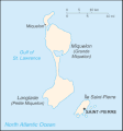
Файл:Saint Pierre and Miquelon map.gif
Saint_Pierre_and_Miquelon_map.gif (330 × 354 кропак, аб’ём файла: 7 KB, тып MIME: image/gif)
Гісторыя файла
Націснуць на даце з часам, каб паказаць файл, якім ён тады быў.
| Дата і час | Драбніца | Памеры | Удзельнік | Тлумачэнне | |
|---|---|---|---|---|---|
| актуальн. | 11:08, 26 чэрвеня 2005 |  | 330 × 354 (7 KB) | Taichi | This is a map of Saint-Pierre and Miquelon from the CIA World Factbook (retrieved from http://www.cia.gov/cia/publications/factbook/geos/sb.html). According to the copyright notice on the website, all information of the World Factbook is in the public do |
Выкарыстанне файла
Наступная 1 старонка выкарыстоўвае гэты файл:
Глабальнае выкарыстанне файла
Гэты файл выкарыстоўваецца ў наступных вікі:
- Выкарыстанне ў be-tarask.wikipedia.org
- Выкарыстанне ў bn.wikipedia.org
- Выкарыстанне ў ca.wikipedia.org
- Выкарыстанне ў cs.wikipedia.org
- Выкарыстанне ў dsb.wikipedia.org
- Выкарыстанне ў el.wikipedia.org
- Выкарыстанне ў en.wikipedia.org
- Выкарыстанне ў eo.wikipedia.org
- Выкарыстанне ў es.wikipedia.org
- Выкарыстанне ў eu.wikipedia.org
- Выкарыстанне ў fa.wikipedia.org
- Выкарыстанне ў fi.wikipedia.org
- Выкарыстанне ў fo.wikipedia.org
- Выкарыстанне ў fr.wikipedia.org
- Выкарыстанне ў hu.wikipedia.org
- Выкарыстанне ў id.wikipedia.org
- Выкарыстанне ў incubator.wikimedia.org
- Выкарыстанне ў io.wikipedia.org
- Выкарыстанне ў it.wikipedia.org
- Выкарыстанне ў ja.wikipedia.org
- Выкарыстанне ў kk.wikipedia.org
- Выкарыстанне ў ko.wikipedia.org
- Выкарыстанне ў ko.wiktionary.org
- Выкарыстанне ў lt.wikipedia.org
- Выкарыстанне ў mk.wikipedia.org
- Выкарыстанне ў nl.wikipedia.org
- Выкарыстанне ў nn.wikipedia.org
- Выкарыстанне ў no.wikipedia.org
- Выкарыстанне ў os.wikipedia.org
- Выкарыстанне ў pl.wikipedia.org
- Выкарыстанне ў pl.wiktionary.org
Паказаць глабальнае выкарыстанне гэтага файла.


