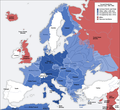
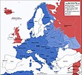
Файл:Second world war europe 1941-1942 map en.png

Змест старонкі недаступны на іншых мовах.
З Вікіпедыі, свабоднай энцыклапедыі

Арыгінальны файл(1 090 × 1 000 кропак, аб’ём файла: 216 KB, тып MIME: image/png)

Гэты файл з на Вікісховішчы і можа выкарыстоўвацца іншымі праектамі. Апісанне на яго старонцы ў Wikimedia Commons прыведзена ніжэй.

This military map image could be re-created using vector graphics as an SVG file. This has several advantages; see Commons:Media for cleanup for more information. If an SVG form of this image is available, please upload it and afterwards replace this template with {{vector version available|new image name}}.


It is recommended to name the SVG file “Second world war europe 1941-1942 map en.svg”—then the template Vector version available (or Vva) does not need the new image name parameter.
Maps of the history of Europe
BCE
aC

Weichselian ice age (c. 113,000–9700) · Neolithic expansion (c. 7000–4500) · Middle Neolithic (c. 4500–4000) · Late Neolithic (c. 4000–3000) · Copper Age – Corded Ware culture (c. 2900–2350) · Copper Age – Bellbeaker culture (c. 2800–1800) · Early Bronze Age – Unetice culture (c. 2300–1600) · Late Bronze Age – Urnfield culture (c. 1300—750) · Migrations (c. 1000–100) · Hallstatt & La Tène cultures (c. 800–100) · Roman Republic (510–40) · 220 · 218 · 200 · 201–100 · 58 · 49 · 39 · 30 BCE–6 CE


CE
dC

14 · 14–37 · 60 · 60 · 69 · 80 · Migrations 100–500 · 117 · 117 · 125 · Migrations 150–774 · Economy 180 · 271 · 293–305 · 337 · 395 · c. 395 · 400 · 400 · 450 · 457–61 · 476 · 480 · Franks 481–814 · Early Slavs 500–700 · 500 · 526 · 526–600 · Christianisation to 600 · c. 550 · 650 · Pontic Steppe 650 · 665 · 800 · Vikings 800–1050 · 814 · 843–70 · 850 · 900 · 912 · 998 · 1000 · 1000 · 1054 · 1092 · First Crusade 1095–99 · 1097 · 1135 · 1142 · 1147–49 · 1190 · 1190 · 1250 · c. 1250 · 1301-1400 · 1301-1400 · 1328 · 1345 · Black Plague 1347–51 · 1360 · 1400 · Trade routes c. 1400 · 1430 · 1470 · 1490 · 1492 · 1500 · 1519 · 1550 · 1560 · Religion 1560 · Religion 1600 · Religion 1618 · 1618–48 · 1648 · 1683 · 1700 · 1701 · 1708 · 1714 · 1721 · 1725–30 · 1739–1740 · 1740 · 1748–66 · 1783–1792 · 1787 · 1787 · 1789 · 1799 · 1812 · 1812 · 1812 · 1812 · 1813 · 1815 · 1815 · 1815 · 1818 · Ottoman Empire 1830–1923 · 1848–49 · 1861 · 1867 · 1871 · 1878 · 1890 · 1905 · 1911 · 1914 · 1914 · 1919 · 1919–29 · 1923 · 1929 · 1930 · 1940 · 1941–42 · 1942–45 · Cold War 1947–91 · 1950 · 1993–2006 · 2006 to date

(this template: · view · discuss )

Тлумачэнне

Annotations
InfoField
This image is annotated: View the annotations at Commons
Апісанне
Deutsch: Karte der vom Deutschen Reich besetzten Gebiete und der Kriegsfronten im Zweiten Weltkrieg, 1941/42.
English: A map of German front of the Second World War circa 1941-1942.
Ελληνικά: Εδαφικές κατακτήσεις του Ράιχ
Español: Conquistas territoriales del Reich
Дата Original Image: 17 April 2005
Derivative Image: 22 December 2005
Крыніца This file was derived from: Second world war europe 1941-1942 map de.png
Аўтар Original Author: User:San Jose
Derivative Author: User:ArmadniGeneral
Дазвол
(Паўторнае выкарыстанне гэтага файла)
This image is a translation of the original, created and released under the terms of the GNU Free Documentation License.
Іншыя версіі

Derivative works of this file:  Großdeutsches Reich-europe.png [правіць]

Ліцэнзіяванне

GNU head Дазваляецца капіяваць, распаўсюджваць і(або) мадыфікаваць гэты дакумент на ўмовах ліцэнзіі GNU FDL версіі 1.2 або навейшай, выдадзенай Фондам свабоднага праграмнага забеспячэння; без Нязменных раздзелаў, без тэкстаў Вокладак. Копія ліцэнзіі ёсць у раздзеле GNU Free Documentation License.
w:en:Creative Commons
атрыбуцыя распаўсюджванне на тых жа ўмовах
Гэты файл даступны па ліцэнзіі Creative Commons Пазначэнне аўтарства - На тых самых умовах 3.0 Непартаваная
Вы можаце свабодна:
  • дзяліцца творам – капіраваць, распаўсюджваць і перадаваць гэты твор.
  • ствараць вытворныя творы – адаптаваць гэты твор
Пры выкананні наступных умоў:
  • атрыбуцыя – вы павінны пазначыць аўтарства гэтага твора, даць спасылку на ліцэнзію і пазначыць ці рабіў аўтар якія-небудзь змены. Гэта можна рабіць кожным зразумелым чынам, але не так, каб наводзіць па думку, што ліцэнзіят падтрымлівае вас або выкарыстанне вамі гэтага твора.
  • распаўсюджванне на тых жа ўмовах – Калі вы змяняеце, адаптуеце ці ствараеце вытворны твор на аснове гэтага, то павінны распаўсюджваць атрыманы ў выніку твор на ўмовах такой самай ці сумяшчальнай ліцэнзіі, што і арыгінал.
Гэтая картка дададзеная ў якасці часткі абнаўлення ліцэнзіі GFDL.

Назвы

Апішыце ў адным радку, што ўяўляе сабой гэты файл
This map represents Europe in 1941-1942

Элементы, адлюстраваныя на гэтым файле

адлюстроўвае

image/png

Гісторыя файла

Націснуць на даце з часам, каб паказаць файл, якім ён тады быў.

Дата і часДрабніцаПамерыУдзельнікТлумачэнне
актуальн.19:20, 5 жніўня 2020Драбніца версіі з 19:20, 5 жніўня 20201 090 × 1 000 (216 KB)Claude ZygielDistinguished statutes
04:00, 28 ліпеня 2018Драбніца версіі з 04:00, 28 ліпеня 20181 090 × 1 000 (184 KB)JeffyPShrinking file size
11:06, 16 лютага 2009Драбніца версіі з 11:06, 16 лютага 20091 090 × 1 000 (214 KB)Guinnog{{Information |Description=better titles |Source=*File:Second_world_war_europe_1941-1942_map_en.png |Date=2009-02-16 08:05 (UTC) |Author=*File:Second_world_war_europe_1941-1942_map_en.png: Sir Lothar *derivative work: ~~~ |Permission=see below
03:22, 11 красавіка 2008Драбніца версіі з 03:22, 11 красавіка 20081 090 × 1 000 (208 KB)Sir Lothar
08:36, 21 снежня 2005Драбніца версіі з 08:36, 21 снежня 20051 090 × 1 000 (221 KB)ArmadniGeneralA map of the Eastern front of the Second World War circa 1941-1942. The original German-language map was created by User:San Jose on 17 April 2005. It can be found here: Image:Second world war europe 1941-1942 map de.png. This image is a translat

Наступная 1 старонка выкарыстоўвае гэты файл:

Глабальнае выкарыстанне файла

Гэты файл выкарыстоўваецца ў наступных вікі:

Паказаць глабальнае выкарыстанне гэтага файла.

Метаданыя