
Файл:Karta över de europeiska delarna av Sovjetunionen på 1920-talet.jpg

Памер папярэдняга прагляду: 439 × 600 пікселяў. Іншыя разрозненні: 176 × 240 пікселяў | 351 × 480 пікселяў | 562 × 768 пікселяў | 750 × 1 024 пікселяў | 2 548 × 3 480 пікселяў.
Арыгінальны файл (2 548 × 3 480 кропак, аб’ём файла: 1,81 MB, тып MIME: image/jpeg)
Тлумачэнне
| Апісанне |
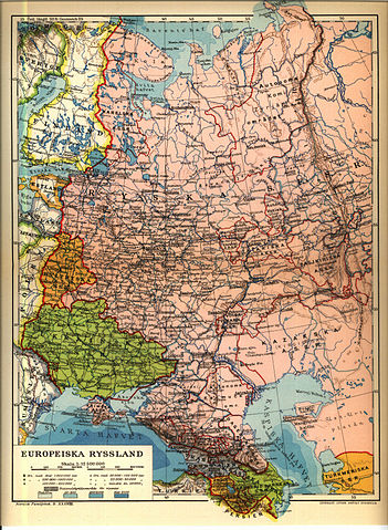
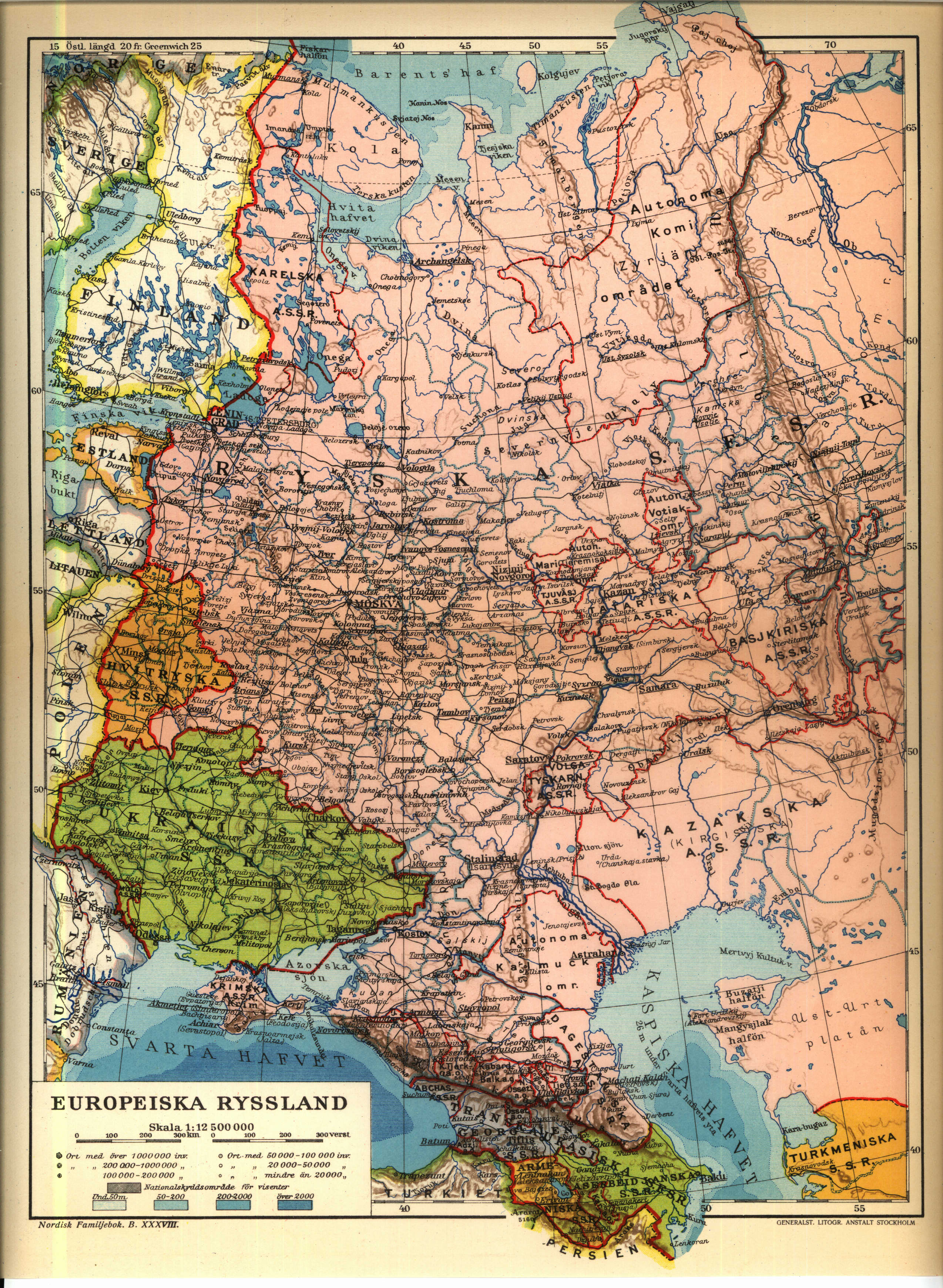
English: 1926 Map of the western Soviet Union region.
Norsk bokmål: från Nordisk familjebok |
||||||||
| Крыніца | https://runeberg.org/nfcr/ryssland.jpg | ||||||||
| Аўтар | User Den fjättrade ankan on sv.wikipedia | ||||||||
| Дазвол (Паўторнае выкарыстанне гэтага файла) |
|
||||||||
| Іншыя версіі |
Derivative works of this file: Karta över de europeiska delarna av Sovjetunionen på 1920-talet Georgiska SSR.jpg, Derivative works of this file: Kaninhalvön.jpg Originally from sv.wikipedia; description page is (was) here * 25 juni 2004 kl.01.54 [[:sv:User:Den fjättrade ankan|Den fjättrade ankan]] 2548x3480 (1 899 294 bytes) <span class="comment">(från Nordisk familjebok)</span> |


(Uploaded using CommonsHelper or PushForCommons)
sv:Kategori:Kartor från Nordisk familjebok
Гісторыя файла
Націснуць на даце з часам, каб паказаць файл, якім ён тады быў.
| Дата і час | Драбніца | Памеры | Удзельнік | Тлумачэнне | |
|---|---|---|---|---|---|
| актуальн. | 01:24, 7 ліпеня 2006 | | 2 548 × 3 480 (1,81 MB) | Nicke L | {{Information| |Description= från Nordisk familjebok sv:Kategori:Kartor från Nordisk familjebok |Source= |Date= |Author=User Den fjättrade ankan on [http://sv.wikipedia.org sv.wikipedia] |Permission={{Ugglanbild} |
Выкарыстанне файла
Наступныя 2 старонкі выкарыстоўваюць гэты файл:
Глабальнае выкарыстанне файла
Гэты файл выкарыстоўваецца ў наступных вікі:
- Выкарыстанне ў be-tarask.wikipedia.org
- Выкарыстанне ў ca.wikipedia.org
- Выкарыстанне ў cs.wikipedia.org
- Выкарыстанне ў de.wikipedia.org
- Выкарыстанне ў en.wikipedia.org
- Выкарыстанне ў fi.wikipedia.org
- Выкарыстанне ў fr.wikipedia.org
- Выкарыстанне ў ru.wikipedia.org
- Выкарыстанне ў sk.wikipedia.org
- Выкарыстанне ў sq.wikipedia.org
- Выкарыстанне ў sr.wikipedia.org
- Выкарыстанне ў tg.wikipedia.org
- Выкарыстанне ў uk.wikipedia.org