
Файл:FortTiconderogaLayout1758.png
Памер папярэдняга прагляду: 800 × 518 пікселяў. Іншыя разрозненні: 320 × 207 пікселяў | 640 × 414 пікселяў | 1 024 × 663 пікселяў | 1 327 × 859 пікселяў.
Арыгінальны файл (1 327 × 859 кропак, аб’ём файла: 2,42 MB, тып MIME: image/png)
| Апісанне |
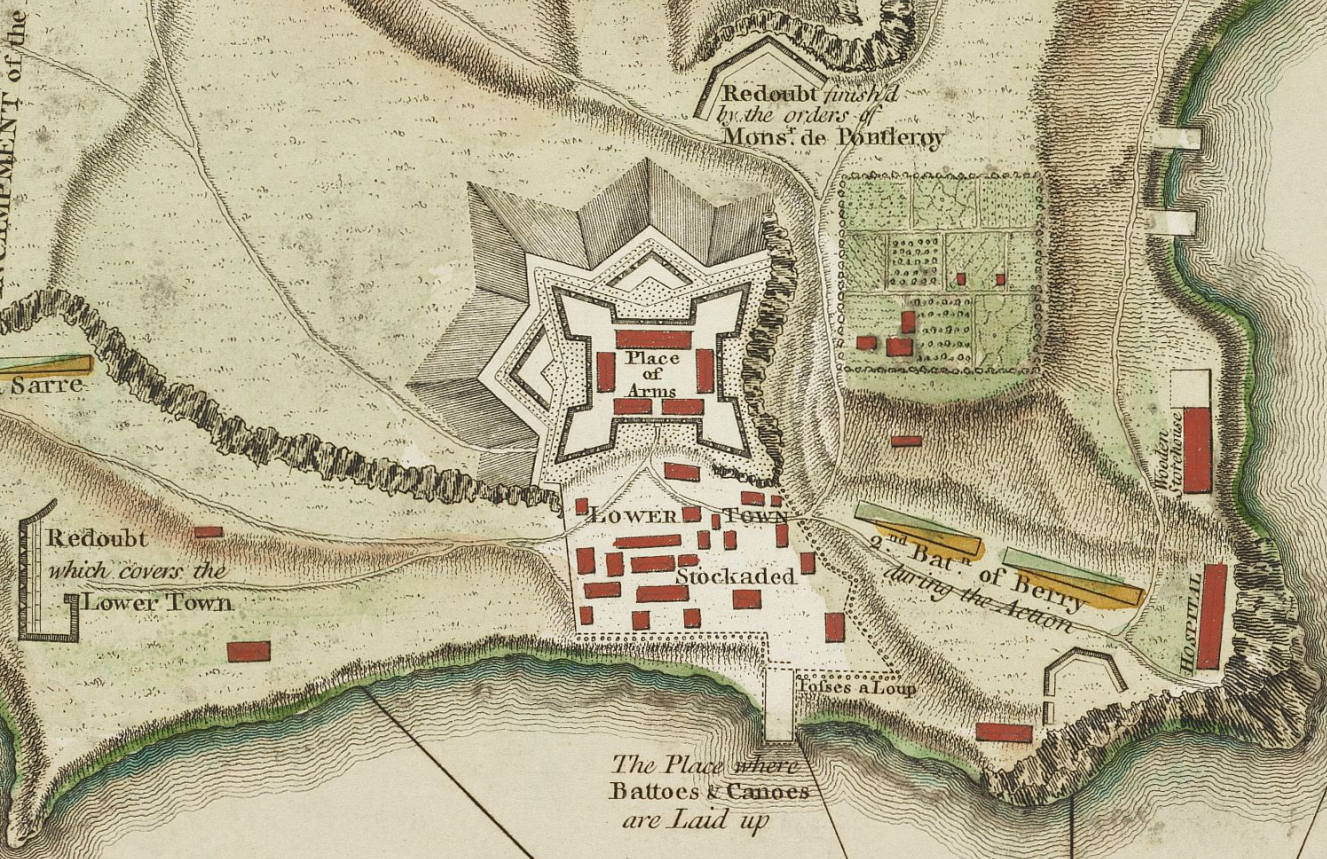
English: This is a detail from the source map showing the the layout of Fort Ticonderoga (then known as Fort Carillon) in 1758. |
||||||||||||||||||||||
| Дата |
|
||||||||||||||||||||||
| Крыніца |
The source image is from the Library and Archive of Quebec. |
||||||||||||||||||||||
| Аўтар |
|
||||||||||||||||||||||
| Дазвол (Паўторнае выкарыстанне гэтага файла) |
|
||||||||||||||||||||||
| Іншыя версіі |
Derivative works of this file: Fort Ticonderoga 1758 Restored.png File:TiconderogaJeffreys1758.jpg (original uncropped map) |
||||||||||||||||||||||
| This is a retouched picture, which means that it has been digitally altered from its original version. Modifications: Detail showing only the fort and its immediate outbuildings. The original can be viewed here: TiconderogaJeffreys1758.jpg:
|
Гісторыя файла
Націснуць на даце з часам, каб паказаць файл, якім ён тады быў.
| Дата і час | Драбніца | Памеры | Удзельнік | Тлумачэнне | |
|---|---|---|---|---|---|
| актуальн. | 19:17, 10 лютага 2009 | | 1 327 × 859 (2,42 MB) | Magicpiano | {{Information |Description={{en|1=This is a period map showing the forces arrayed at the Battle of Carillon at Fort Ticonderoga (then known as Fort Carillon) in 1758. It is captioned ''A Plan of the Town |
Выкарыстанне файла
Няма старонак, якія выкарыстоўваюць гэты файл.
Глабальнае выкарыстанне файла
Гэты файл выкарыстоўваецца ў наступных вікі:
- Выкарыстанне ў en.wikipedia.org
- Выкарыстанне ў fr.wikipedia.org
- Выкарыстанне ў ja.wikipedia.org
- Выкарыстанне ў sv.wikipedia.org