
Файл:Map of Texas highlighting Limestone County.svg

Памер гэтага PNG-прагляду для SVG-файла: 631 × 600 пікселяў. Іншыя разрозненні: 253 × 240 пікселяў | 505 × 480 пікселяў | 808 × 768 пікселяў | 1 077 × 1 024 пікселяў | 2 155 × 2 048 пікселяў | 12 473 × 11 855 пікселяў.
Арыгінальны файл (файл SVG, намінальна 12 473 × 11 855 кропак, аб’ём файла: 304 KB)
Тлумачэнне
| Апісанне |
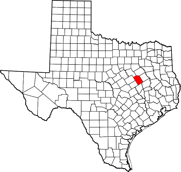
English: This is a locator map showing Limestone County in Texas. For more information, see Commons:United States county locator maps. |
| Дата | |
| Крыніца |
Уласная праца: English: The maps use data from nationalatlas.gov, specifically countyp020.tar.gz on the Raw Data Download page. The maps also use state outline data from statesp020.tar.gz. The Florida maps use hydrogm020.tar.gz to display Lake Okeechobee. |
| Аўтар | David Benbennick |
Ліцэнзіяванне
| Я, уладальнік аўтарскіх правоў на гэты твор, перадаю яго ў грамадскі набытак. Дазвол сапраўдны для ўсяго свету. У некаторых краінах гэта не можа быць юрыдычна магчыма; калі так, то: Я дазваляю кожнаму выкарыстоўваць гэтую працу ў любых мэтах, без аніякіх умоваў, калі толькі такія ўмовы не патрабуюцца паводле закону. |
Гісторыя файла
Націснуць на даце з часам, каб паказаць файл, якім ён тады быў.
| Дата і час | Драбніца | Памеры | Удзельнік | Тлумачэнне | |
|---|---|---|---|---|---|
| актуальн. | 20:11, 12 лютага 2006 | | 12 473 × 11 855 (304 KB) | David Benbennick | {{subst:User:Dbenbenn/clm|county=Limestone County|state=Texas|type=county}} |
Выкарыстанне файла
Наступная 1 старонка выкарыстоўвае гэты файл:
Глабальнае выкарыстанне файла
Гэты файл выкарыстоўваецца ў наступных вікі:
- Выкарыстанне ў ar.wikipedia.org
- Выкарыстанне ў arz.wikipedia.org
- Выкарыстанне ў bg.wikipedia.org
- Выкарыстанне ў bpy.wikipedia.org
- Выкарыстанне ў cdo.wikipedia.org
- Выкарыстанне ў ceb.wikipedia.org
- Выкарыстанне ў cs.wikipedia.org
- Выкарыстанне ў cy.wikipedia.org
- Выкарыстанне ў da.wikipedia.org
- Выкарыстанне ў de.wikipedia.org
- Выкарыстанне ў en.wikipedia.org
- List of counties in Texas
- Limestone County, Texas
- Coolidge, Texas
- Groesbeck, Texas
- Kosse, Texas
- Mexia, Texas
- Tehuacana, Texas
- Thornton, Texas
- Mart, Texas
- Lake Limestone
- File talk:Map of Texas highlighting Limestone County.svg
- Template:Limestone County, Texas
- Category:Wikipedia requested photographs in Limestone County, Texas
- User:Nyttend/County templates/TX/2
- Prairie Hill, Limestone County, Texas
- Ben Hur, Texas
- Forest Glade, Texas
- Template:LimestoneCountyTX-geo-stub
- Category:Populated places in Limestone County, Texas
- Buffalo Mop, Texas
- National Register of Historic Places listings in Limestone County, Texas
- Tehuacana Hills
- Farrar, Texas
- Oletha, Texas
- Выкарыстанне ў eo.wikipedia.org
- Выкарыстанне ў es.wikipedia.org
Паказаць глабальнае выкарыстанне гэтага файла.