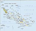
Файл:Political map of the Solomon Islands archipelago in 1989.jpg

Памер папярэдняга прагляду: 690 × 600 пікселяў. Іншыя разрозненні: 276 × 240 пікселяў | 552 × 480 пікселяў | 748 × 650 пікселяў.
Арыгінальны файл (748 × 650 кропак, аб’ём файла: 72 KB, тып MIME: image/jpeg)
Гісторыя файла
Націснуць на даце з часам, каб паказаць файл, якім ён тады быў.
| Дата і час | Драбніца | Памеры | Удзельнік | Тлумачэнне | |
|---|---|---|---|---|---|
| актуальн. | 05:06, 12 красавіка 2016 |  | 748 × 650 (72 KB) | Nimbosa | Reverted to version as of 02:02, 12 April 2016 (UTC) |
| 05:05, 12 красавіка 2016 |  | 748 × 650 (72 KB) | Nimbosa | restored to original color as on print, corrected color map | |
| 05:02, 12 красавіка 2016 |  | 748 × 650 (72 KB) | Nimbosa | restored to original color as on print, corrected color map | |
| 00:09, 2 сакавіка 2007 |  | 748 × 650 (72 KB) | Pibwl |
Выкарыстанне файла
Няма старонак, якія выкарыстоўваюць гэты файл.
Глабальнае выкарыстанне файла
Гэты файл выкарыстоўваецца ў наступных вікі:
- Выкарыстанне ў als.wikipedia.org
- Выкарыстанне ў ami.wikipedia.org
- Выкарыстанне ў ast.wikipedia.org
- Выкарыстанне ў bg.wikipedia.org
- Выкарыстанне ў bn.wikipedia.org
- Выкарыстанне ў ca.wikipedia.org
- Выкарыстанне ў ceb.wikipedia.org
- Выкарыстанне ў cs.wikipedia.org
- Выкарыстанне ў da.wikipedia.org
- Выкарыстанне ў el.wikipedia.org
- Выкарыстанне ў en.wikipedia.org
- New Georgia Islands
- Solomon Islands rain forests
- New Georgia Sound
- New Georgia
- North Solomon Islands
- Solomon Archipelago
- List of resident commissioners and governors of the Solomon Islands
- Solomon Islands (archipelago)
- Bougainville Strait
- Coral reefs of the Solomon Islands
- Draft:Arthur William Mahaffy
- Выкарыстанне ў en.wiktionary.org
- Выкарыстанне ў es.wikipedia.org
- Выкарыстанне ў fa.wikipedia.org
- Выкарыстанне ў fi.wikipedia.org
- Выкарыстанне ў fr.wikipedia.org
- Выкарыстанне ў gl.wikipedia.org
- Выкарыстанне ў hu.wikipedia.org
- Выкарыстанне ў hy.wikipedia.org
- Выкарыстанне ў hyw.wikipedia.org
- Выкарыстанне ў id.wikipedia.org
- Выкарыстанне ў it.wikipedia.org
- Выкарыстанне ў ja.wikipedia.org
- Выкарыстанне ў ka.wikipedia.org
- Выкарыстанне ў kk.wikipedia.org
Паказаць глабальнае выкарыстанне гэтага файла.


