
Файл:ProtectoradoBohemiaMoravia.PNG
Няма версіі з большай раздзяляльнасцю.
ProtectoradoBohemiaMoravia.PNG (698 × 415 кропак, аб’ём файла: 107 KB, тып MIME: image/png)

|
This locator map image could be re-created using vector graphics as an SVG file. This has several advantages; see Commons:Media for cleanup for more information. If an SVG form of this image is available, please upload it and afterwards replace this template with
{{vector version available|new image name}}.
It is recommended to name the SVG file “ProtectoradoBohemiaMoravia.svg”—then the template Vector version available (or Vva) does not need the new image name parameter. |
Тлумачэнне
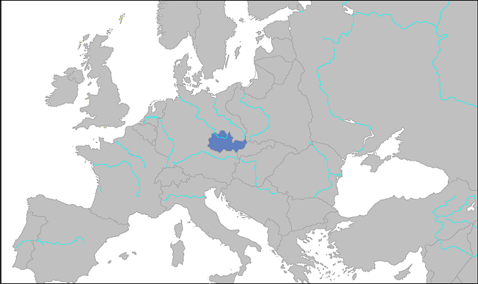
Deutsch: Lage des „Reichsprotektorats Böhmen und Mähren“ 1939
English: Location of the “Protectorate of Bohemia and Moravia” in 1939
Español: Protectorado de Bohemia y Moravia, 1939
Ліцэнзіяванне
| Я, уладальнік аўтарскіх правоў на гэты твор, перадаю яго ў грамадскі набытак. Дазвол сапраўдны для ўсяго свету. У некаторых краінах гэта не можа быць юрыдычна магчыма; калі так, то: Я дазваляю кожнаму выкарыстоўваць гэтую працу ў любых мэтах, без аніякіх умоваў, калі толькі такія ўмовы не патрабуюцца паводле закону. |
Гісторыя файла
Націснуць на даце з часам, каб паказаць файл, якім ён тады быў.
| Дата і час | Драбніца | Памеры | Удзельнік | Тлумачэнне | |
|---|---|---|---|---|---|
| актуальн. | 03:09, 2 красавіка 2007 | | 698 × 415 (107 KB) | Dove | Protectorado de Bohemia y Moravia. Category: Maps of World War II |
| 03:06, 2 красавіка 2007 |  | 872 × 518 (110 KB) | Dove | Protectorado de Bohemia y Moravia Category: Maps of World War II |
Выкарыстанне файла
Наступная 1 старонка выкарыстоўвае гэты файл:
Глабальнае выкарыстанне файла
Гэты файл выкарыстоўваецца ў наступных вікі:
- Выкарыстанне ў be-tarask.wikipedia.org
- Выкарыстанне ў eu.wikipedia.org
- Выкарыстанне ў io.wikipedia.org
- Выкарыстанне ў ro.wikipedia.org