
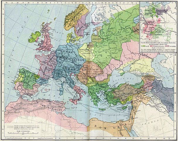
Файл:Europe mediterranean 1190.jpg

Памер папярэдняга прагляду: 760 × 600 пікселяў. Іншыя разрозненні: 304 × 240 пікселяў | 608 × 480 пікселяў | 973 × 768 пікселяў | 1 280 × 1 010 пікселяў | 2 293 × 1 810 пікселяў.
Арыгінальны файл (2 293 × 1 810 кропак, аб’ём файла: 834 KB, тып MIME: image/jpeg)
Тлумачэнне
| Апісанне | Europa en 1190. |
| Дата | |
| Крыніца | Perry-Castañeda Library, Map Collection: From the "Historical Atlas" by William R. Shepherd, New York, Henry Holt and Company, 1923 |
| Аўтар | Roke |
| Іншыя версіі | العربيَّة |
.jpg)
.jpg)
_en.png)
.png)
.jpg)
Ліцэнзіяванне
|
This work is in the public domain in its country of origin and other countries and areas where the copyright term is the author's life plus 70 years or fewer. This work is in the public domain in the United States because it was published (or registered with the U.S. Copyright Office) before January 1, 1929. | |
| Гэты файл быў ідэнтыфікаваны як вольны ад вядомых абмежаванняў, згодна з законам аб аўтарскім праве, а таксама ад усіх сумежных правоў. | |
Гісторыя файла
Націснуць на даце з часам, каб паказаць файл, якім ён тады быў.
| Дата і час | Драбніца | Памеры | Удзельнік | Тлумачэнне | |
|---|---|---|---|---|---|
| актуальн. | 18:46, 28 мая 2011 | | 2 293 × 1 810 (834 KB) | Reddi~commonswiki | |
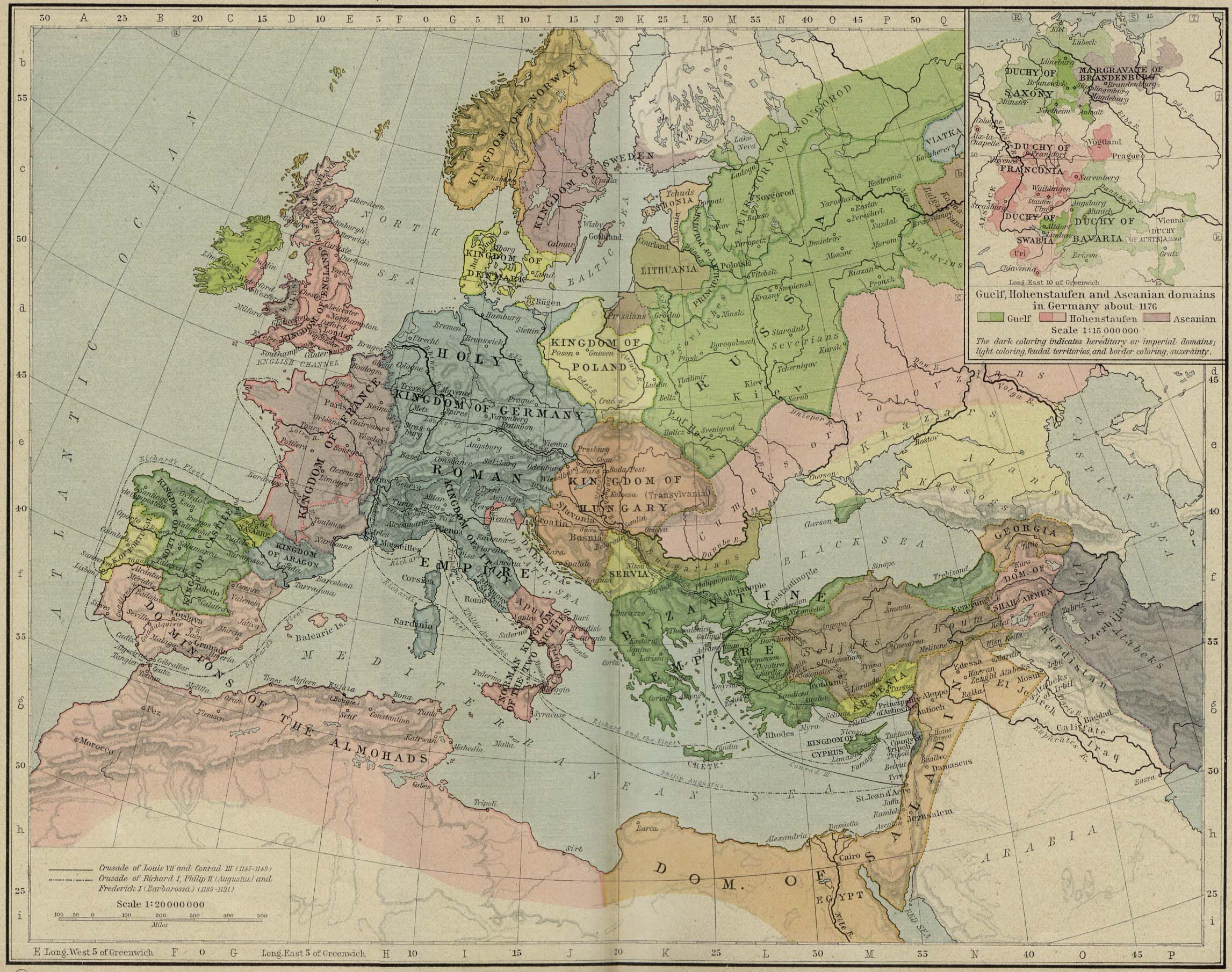
| 13:30, 8 мая 2006 |  | 2 293 × 1 810 (667 KB) | Roke~commonswiki | Europe in 1190 {{Europe}} {{PD-PCL|http://www.lib.utexas.edu/maps/historical/shepherd/europe_mediterranean_1190.jpg}} Category: Historical maps of Europe |
Выкарыстанне файла
Наступная 1 старонка выкарыстоўвае гэты файл:
Глабальнае выкарыстанне файла
Гэты файл выкарыстоўваецца ў наступных вікі:
- Выкарыстанне ў azb.wikipedia.org
- Выкарыстанне ў az.wikipedia.org
- Выкарыстанне ў bn.wikibooks.org
- Выкарыстанне ў ca.wikipedia.org
- Выкарыстанне ў cs.wikipedia.org
- Выкарыстанне ў cy.wikipedia.org
- Выкарыстанне ў da.wikipedia.org
- Выкарыстанне ў de.wikipedia.org
- Выкарыстанне ў el.wikipedia.org
- Выкарыстанне ў en.wikipedia.org
- Выкарыстанне ў en.wikibooks.org
- Выкарыстанне ў eo.wikipedia.org
- Выкарыстанне ў es.wikipedia.org
- Выкарыстанне ў et.wikipedia.org
Паказаць глабальнае выкарыстанне гэтага файла.