З Вікіпедыі, свабоднай энцыклапедыі
Арыгінальны файл (5 700 × 4 180 кропак, аб’ём файла: 11,69 MB, тып MIME: image/jpeg )
Тлумачэнне Ліцэнзіяванне
Public domain Public domain false false
This file is in the public domain NASA . NASA copyright policy states that "NASA material is not protected by copyright unless noted ". (See Template:PD-USGov , NASA copyright policy page or JPL Image Use Policy .)
Warnings:
1318
1346
335
306
5700
4180
1760
2215
292
363
5700
4180
2301
1588
249
256
5700
4180
2038
1951
207
221
5700
4180
1703
1545
905
1075
5700
4180
1981
1488
57
57
5700
4180
1739
1987
93
71
5700
4180
1838
1973
64
71
5700
4180
4047
3496
663
406
5700
4180
4674
3646
200
135
5700
4180
5045
3838
192
150
5700
4180
5415
3696
164
142
5700
4180
3071
3689
178
135
5700
4180
2152
2499
492
954
5700
4180
2244
2186
549
356
5700
4180
577
3311
257
171
5700
4180
228
3546
271
235
5700
4180
21
2898
1304
470
5700
4180
5394
249
100
64
5700
4180
3570
2414
513
214
5700
4180
2814
2215
442
71
5700
4180
3263
2215
456
164
5700
4180
3370
2172
178
107
5700
4180
3242
2086
178
93
5700
4180
3149
1880
121
256
5700
4180
2957
1374
78
71
5700
4180
3356
1111
705
356
5700
4180
3320
1645
86
235
5700
4180
3776
1403
428
741
5700
4180
3712
2143
128
142
5700
4180
4054
2272
328
128
5700
4180
4090
2321
413
256
5700
4180
4111
2407
470
278
5700
4180
4603
2877
121
107
5700
4180
4532
2955
121
192
5700
4180
4296
1581
200
520
5700
4180
4254
2058
78
85
5700
4180
3926
2015
128
135
5700
4180
5002
1923
157
171
5700
4180
4667
1481
570
620
5700
4180
4603
1146
285
869
5700
4180
4496
1973
249
171
5700
4180
4453
2264
356
199
5700
4180
4788
2143
221
171
5700
4180
4097
776
1012
805
5700
4180
3855
7
1838
776
5700
4180
192
762
884
919
5700
4180
976
1773
299
370
5700
4180
912
983
648
719
5700
4180
1824
570
777
513
5700
4180
2152
883
249
605
5700
4180
2394
7
1104
1225
5700
4180
1974
71
549
1082
5700
4180
1176
805
477
242
5700
4180
962
2072
207
164
5700
4180
898
2200
114
498
5700
4180
591
1709
235
427
5700
4180
4902
2371
242
214
5700
4180
4788
2742
86
164
5700
4180
5472
1937
221
313
5700
4180
2800
1624
100
100
5700
4180
4282
2927
292
171
5700
4180
5102
1211
278
320
5700
4180
4503
3888
207
150
5700
4180
3990
3881
314
292
5700
4180
3050
441
855
648
5700
4180
1746
1538
164
399
5700
4180
684
2542
591
235
5700
4180
1995
1246
228
150
5700
4180
2487
3447
285
449
5700
4180
2772
2350
107
114
5700
4180
2814
2279
470
150
5700
4180
3263
2321
321
235
5700
4180
5087
2086
257
142
5700
4180
5023
2257
235
128
5700
4180
4738
1702
78
93
5700
4180
3840
1189
100
93
5700
4180
2594
1289
107
85
5700
4180
2601
1225
64
64
5700
4180
2722
1175
135
142
5700
4180
беларуская Апішыце ў адным радку, што ўяўляе сабой гэты файл
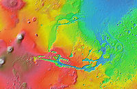
англійская Relief map of the western hemisphere of Mars
шведская Topografisk karta över Mars västra halvklot, med Tharsis-platån och Valles Marineris.
Гісторыя файла
Націснуць на даце з часам, каб паказаць файл, якім ён тады быў.
Дата і час Драбніца Памеры Удзельнік Тлумачэнне актуальн. 07:02, 13 лютага 2013 5 700 × 4 180 (11,69 MB) WolfmanSF Slightly larger view to include the entire east-west extent of the western hemisphere, and to center the equator. 13:15, 9 лютага 2013 5 040 × 4 000 (9,81 MB) WolfmanSF User created page with UploadWizard
Выкарыстанне файла
Наступная 1 старонка выкарыстоўвае гэты файл:
Глабальнае выкарыстанне файла
Гэты файл выкарыстоўваецца ў наступных вікі:
Выкарыстанне ў ar.wikipedia.org
Выкарыстанне ў azb.wikipedia.org
Выкарыстанне ў az.wikipedia.org
Выкарыстанне ў el.wikipedia.org
Выкарыстанне ў en.wikipedia.org
Выкарыстанне ў es.wikipedia.org
Выкарыстанне ў et.wikipedia.org
Выкарыстанне ў fr.wikipedia.org
Выкарыстанне ў fr.wikibooks.org
Выкарыстанне ў hu.wikipedia.org
Выкарыстанне ў ja.wikipedia.org
Выкарыстанне ў ko.wikipedia.org
Выкарыстанне ў mk.wikipedia.org
Выкарыстанне ў pl.wikipedia.org
Выкарыстанне ў ru.wikipedia.org
Выкарыстанне ў sv.wikipedia.org
Выкарыстанне ў ta.wikipedia.org
Выкарыстанне ў th.wikipedia.org
Выкарыстанне ў uk.wikipedia.org
Выкарыстанне ў www.wikidata.org
Выкарыстанне ў zh-yue.wikipedia.org
Выкарыстанне ў zh.wikipedia.org
У файле ёсць дадатковыя звесткі, магчыма, дададзеныя лічбавай фотакамерай ці сканерам, з якіх гэты файл паходзіць. Калі арыгінальны файл быў зменены, то частка гэтых звестак магла страціць актуальнасць у дачыненні да змененага файла.


