
Файл:1761 Homann Heirs Map of Iceland "Insulae Islandiae" - Geographicus - Islandiae-hmhr-1761.jpg
Памер папярэдняга прагляду: 745 × 600 пікселяў. Іншыя разрозненні: 298 × 240 пікселяў | 597 × 480 пікселяў | 954 × 768 пікселяў | 1 272 × 1 024 пікселяў | 2 500 × 2 012 пікселяў.
Арыгінальны файл (2 500 × 2 012 кропак, аб’ём файла: 1,58 MB, тып MIME: image/jpeg)
| Insuale Islandiae | ||||||
|---|---|---|---|---|---|---|
| Мастак | ||||||
| Назва |
Insuale Islandiae |
|||||
| Апісанне |
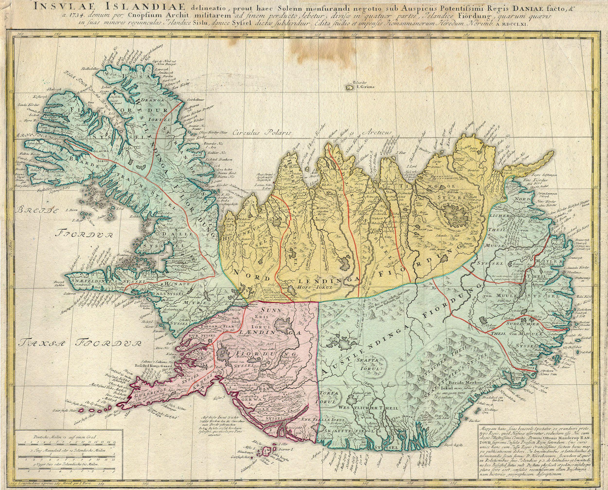
English: This is a rare and spectacular 1761 Homann Heirs map depicting Iceland. Fine map of this region compiled according to Danish surveys. Lovers of Icelandic sagas will recognize many of the towns and cities noted. |
|||||
| Дата | 1761 | |||||
| Памеры | Вышыня: 19 in (48,2 см); шырыня: 21,5 in (54,6 см) | |||||
| Асабісты нумар |
Geographicus link: Islandiae-hmhr-1761 |
|||||
| Крыніца/Фатограф |
|
|||||
| Дазвол (Паўторнае выкарыстанне гэтага файла) |
|
|||||
Гісторыя файла
Націснуць на даце з часам, каб паказаць файл, якім ён тады быў.
| Дата і час | Драбніца | Памеры | Удзельнік | Тлумачэнне | |
|---|---|---|---|---|---|
| актуальн. | 13:03, 24 сакавіка 2011 | | 2 500 × 2 012 (1,58 MB) | BotMultichillT | {{subst:User:Multichill/Geographicus |link=http://www.geographicus.com/P/AntiqueMap/Islandiae-hmhr-1761 |product_name=1761 Homann Heirs Map of Iceland "Insulae Islandiae" |map_title=Insuale Islandiae |description=This is a rare and spectacular 1761 Homann |
Выкарыстанне файла
Наступная 1 старонка выкарыстоўвае гэты файл:
Глабальнае выкарыстанне файла
Гэты файл выкарыстоўваецца ў наступных вікі:
- Выкарыстанне ў ar.wikipedia.org
- Выкарыстанне ў be-tarask.wikipedia.org
- Выкарыстанне ў br.wikipedia.org
- Выкарыстанне ў ca.wikipedia.org
- Выкарыстанне ў da.wikipedia.org
- Выкарыстанне ў da.wikibooks.org
- Выкарыстанне ў de.wikipedia.org
- Выкарыстанне ў en.wikipedia.org
- Выкарыстанне ў es.wikipedia.org
- Выкарыстанне ў fr.wikipedia.org
- Выкарыстанне ў gd.wikipedia.org
- Выкарыстанне ў gl.wikipedia.org
- Выкарыстанне ў hu.wikipedia.org
- Выкарыстанне ў is.wikipedia.org
- Выкарыстанне ў ja.wikipedia.org
- Выкарыстанне ў ko.wikipedia.org
- Выкарыстанне ў nl.wikipedia.org
- Выкарыстанне ў pt.wikipedia.org
- Выкарыстанне ў ru.wikipedia.org
- Выкарыстанне ў sv.wikipedia.org
- Выкарыстанне ў uk.wikipedia.org