
Файл:Gale big.jpg
Памер папярэдняга прагляду: 800 × 554 пікселяў. Іншыя разрозненні: 320 × 222 пікселяў | 640 × 443 пікселяў | 1 024 × 709 пікселяў | 1 280 × 887 пікселяў | 2 953 × 2 046 пікселяў.
Арыгінальны файл (2 953 × 2 046 кропак, аб’ём файла: 1,26 MB, тып MIME: image/jpeg)


Тлумачэнне
| Апісанне |
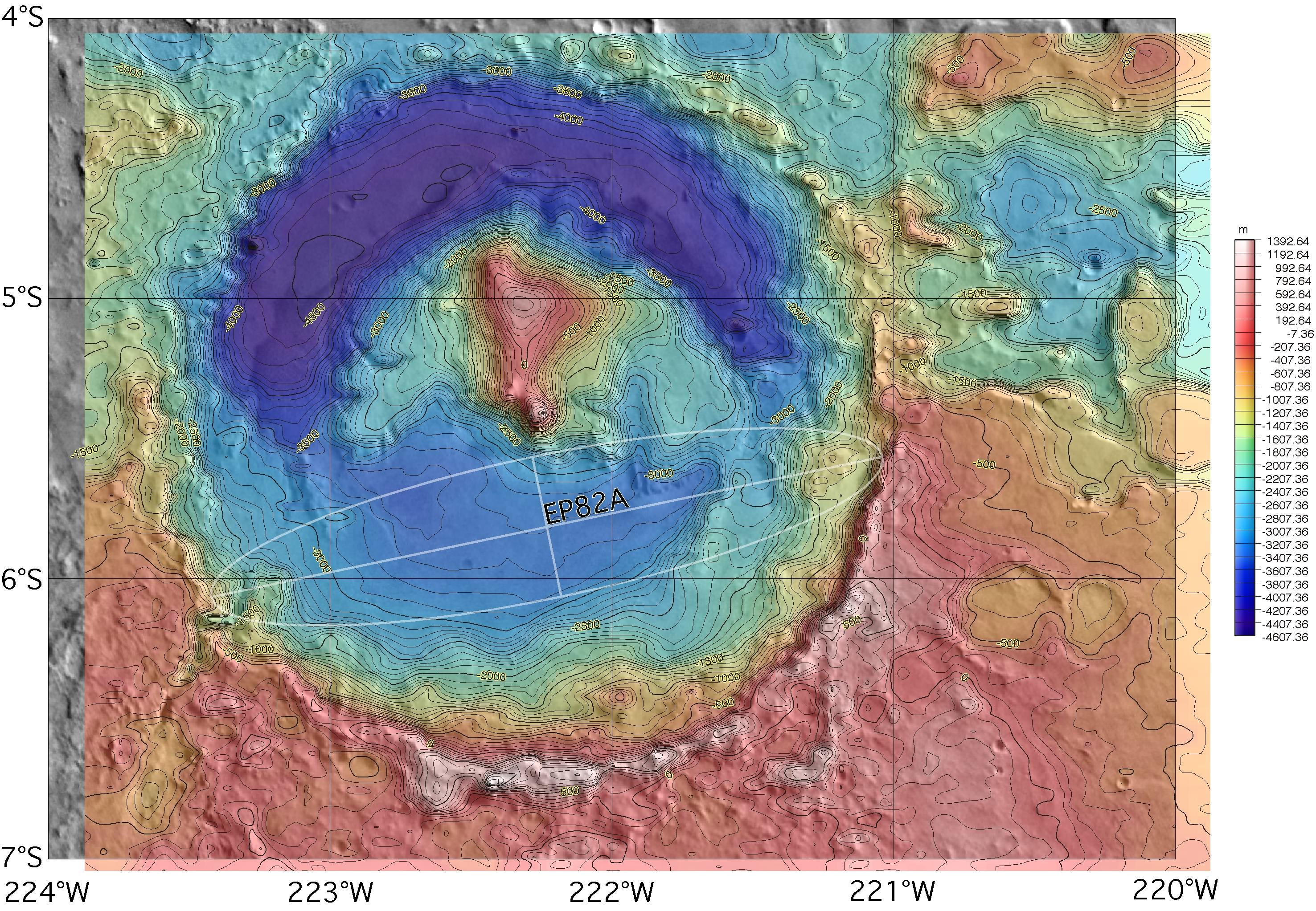
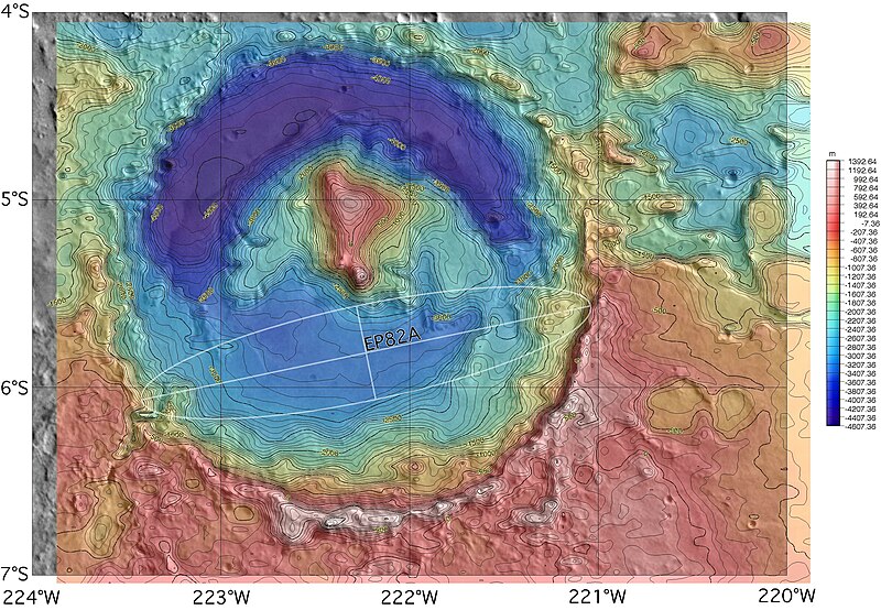
English: Topographic map of Gale crater on Mars, with the proposed but rejected landing ellipse for the MER-A superimposed. The MER lander was ultimately sent elsewhere, but the opposite side of the crater was selected for the 2011 Mars Science Laboratory rover. |
| Крыніца | http://marsoweb.nas.nasa.gov/landingsites/mer2003/topsites/Gale/ (image link) |
| Аўтар | NASA; MOLA topographic map gridded, colored and contoured by Scott Anderson |
| Іншыя версіі |
 |
| Location on Mars | View this and other nearby images on: Google Maps |
|---|
Ліцэнзіяванне
| This file is in the public domain in the United States because it was solely created by NASA. NASA copyright policy states that "NASA material is not protected by copyright unless noted". (See Template:PD-USGov, NASA copyright policy page or JPL Image Use Policy.) | ||
 |
Warnings:
|
Гісторыя файла
Націснуць на даце з часам, каб паказаць файл, якім ён тады быў.
| Дата і час | Драбніца | Памеры | Удзельнік | Тлумачэнне | |
|---|---|---|---|---|---|
| актуальн. | 05:08, 13 лістапада 2007 | | 2 953 × 2 046 (1,26 MB) | Bryan Derksen | {{Information |Description={{en|Topographic map of Gale crater on Mars, with the proposed landing ellipse for the en:Mars Exploration Rover MER-A superimposed. The MER lander was ultimately sent elsewhere, but the site is also a candidate for the upco |
Выкарыстанне файла
Наступная 1 старонка выкарыстоўвае гэты файл:
Глабальнае выкарыстанне файла
Гэты файл выкарыстоўваецца ў наступных вікі:
- Выкарыстанне ў hr.wikipedia.org
- Выкарыстанне ў hy.wikipedia.org
- Выкарыстанне ў id.wikipedia.org
- Выкарыстанне ў pt.wikipedia.org
- Выкарыстанне ў ro.wikipedia.org
- Выкарыстанне ў uk.wikipedia.org