
Файл:Map danavirki.JPG

Памер папярэдняга прагляду: 800 × 600 пікселяў. Іншыя разрозненні: 320 × 240 пікселяў | 640 × 480 пікселяў | 1 024 × 768 пікселяў | 1 280 × 960 пікселяў | 1 600 × 1 200 пікселяў.
Арыгінальны файл (1 600 × 1 200 кропак, аб’ём файла: 1,17 MB, тып MIME: image/jpeg)
Тлумачэнне
| Апісанне |
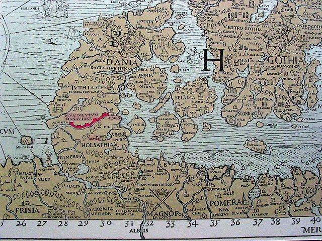
English: A part of Carta Marina showing the Danavirki, the Danish defence wall. |
| Дата | |
| Крыніца | https://commons.wikimedia.org/wiki/File:Carta_Marina.jpeg , Photo: Arne List, 2004, taken in the Viking Museum of Haithabu |
| Аўтар | Olaus Magnus |
| Іншыя версіі |

Ліцэнзіяванне
|
This is a faithful photographic reproduction of a two-dimensional, public domain work of art. The work of art itself is in the public domain for the following reason:
The official position taken by the Wikimedia Foundation is that "faithful reproductions of two-dimensional public domain works of art are public domain".
This photographic reproduction is therefore also considered to be in the public domain in the United States. In other jurisdictions, re-use of this content may be restricted; see Reuse of PD-Art photographs for details. | ||||
Гісторыя файла
Націснуць на даце з часам, каб паказаць файл, якім ён тады быў.
| Дата і час | Драбніца | Памеры | Удзельнік | Тлумачэнне | |
|---|---|---|---|---|---|
| актуальн. | 11:45, 18 жніўня 2005 | | 1 600 × 1 200 (1,17 MB) | Arne List | *Danavirki, the Danish defence wall, on an old map *Photo: Arne List, 2004 {{GFDL}} |
Выкарыстанне файла
Наступная 1 старонка выкарыстоўвае гэты файл:
Глабальнае выкарыстанне файла
Гэты файл выкарыстоўваецца ў наступных вікі:
- Выкарыстанне ў arz.wikipedia.org
- Выкарыстанне ў ca.wikipedia.org
- Выкарыстанне ў da.wikipedia.org
- Выкарыстанне ў de.wikipedia.org
- Выкарыстанне ў en.wikipedia.org
- Выкарыстанне ў es.wikipedia.org
- Выкарыстанне ў et.wikipedia.org
- Выкарыстанне ў eu.wikipedia.org
- Выкарыстанне ў fi.wikipedia.org
- Выкарыстанне ў fr.wikipedia.org
- Выкарыстанне ў hu.wikipedia.org
- Выкарыстанне ў incubator.wikimedia.org
- Выкарыстанне ў is.wikipedia.org
- Выкарыстанне ў it.wikipedia.org
- Выкарыстанне ў ja.wikipedia.org
- Выкарыстанне ў la.wikipedia.org
- Выкарыстанне ў lv.wikipedia.org
- Выкарыстанне ў mk.wikipedia.org
- Выкарыстанне ў nds-nl.wikipedia.org
- Выкарыстанне ў nl.wikipedia.org
- Выкарыстанне ў oc.wikipedia.org
- Выкарыстанне ў pl.wikipedia.org
- Выкарыстанне ў pt.wikipedia.org
- Выкарыстанне ў ro.wikipedia.org
- Выкарыстанне ў ru.wikipedia.org
- Выкарыстанне ў sl.wikipedia.org
- Выкарыстанне ў sv.wikipedia.org
- Выкарыстанне ў uk.wikipedia.org
- Выкарыстанне ў www.wikidata.org